
Coastal Erosion Vulnerability Investigation
With seismic techniqes, Coastal Hazard Risk Management and Adaption Plans can more accurately determine coastlines with high vulnerability for coastal erosion in relation to climate change.
Perth, Western Australia
As a requirement of Western Australia’s State Coastal Planning Policy, local councils are formulating Coastal Hazard Risk Management and Adaptation Plans (CHRMAP) to determine sections of the coastline with a high vulnerability for coastal erosion and inundation due to predicted sea-level rise and increase in frequency and destructive force of storm events.
Geomorphic modelling carried out during the CHRMAP process often assumes a ‘sandy coastline’ where there is no evidence of surface rock along the shoreline or coastal dune system. Such an assumption can prove to be erroneous in predicting whether existing coastal infrastructure is at risk, whilst also prohibiting new coastal land development. With the use of geophysical methods, the potential existence of rock within the subsurface which can act as hard natural barriers to slow down the rate of erosion can be ascertained.
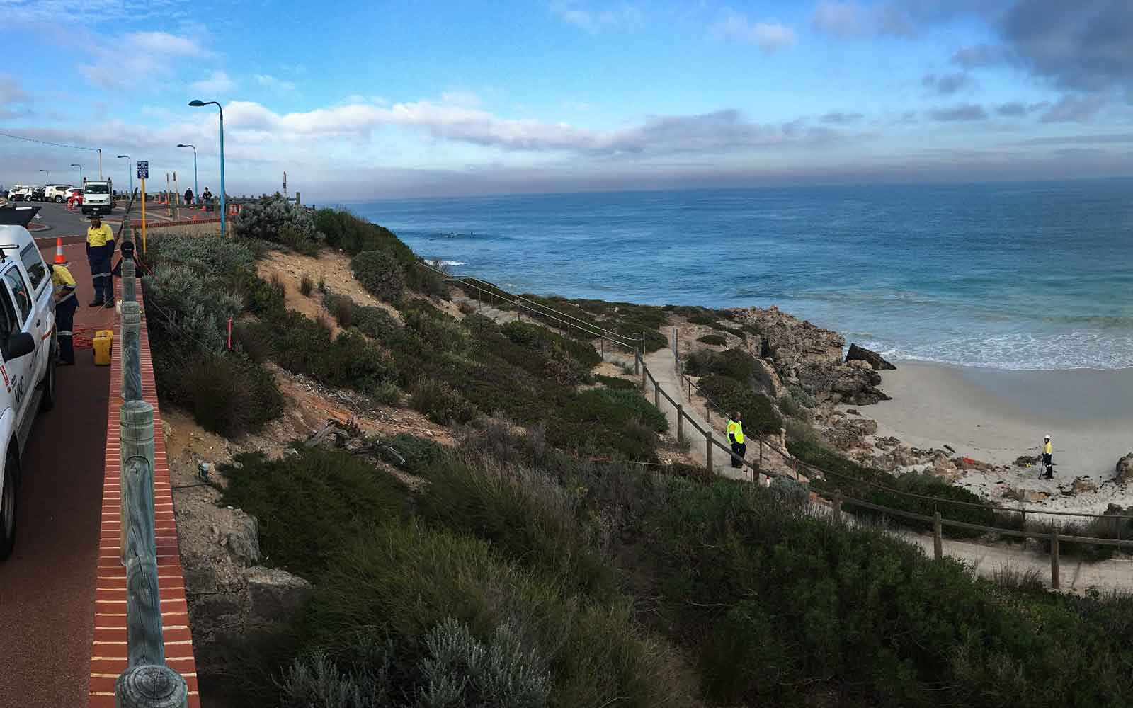
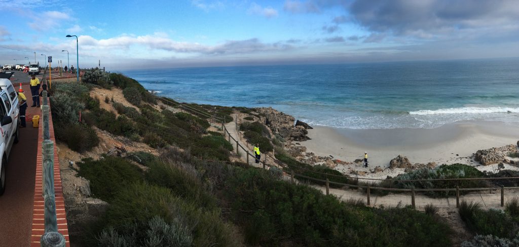
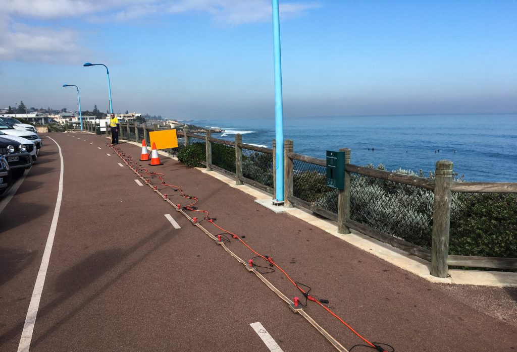
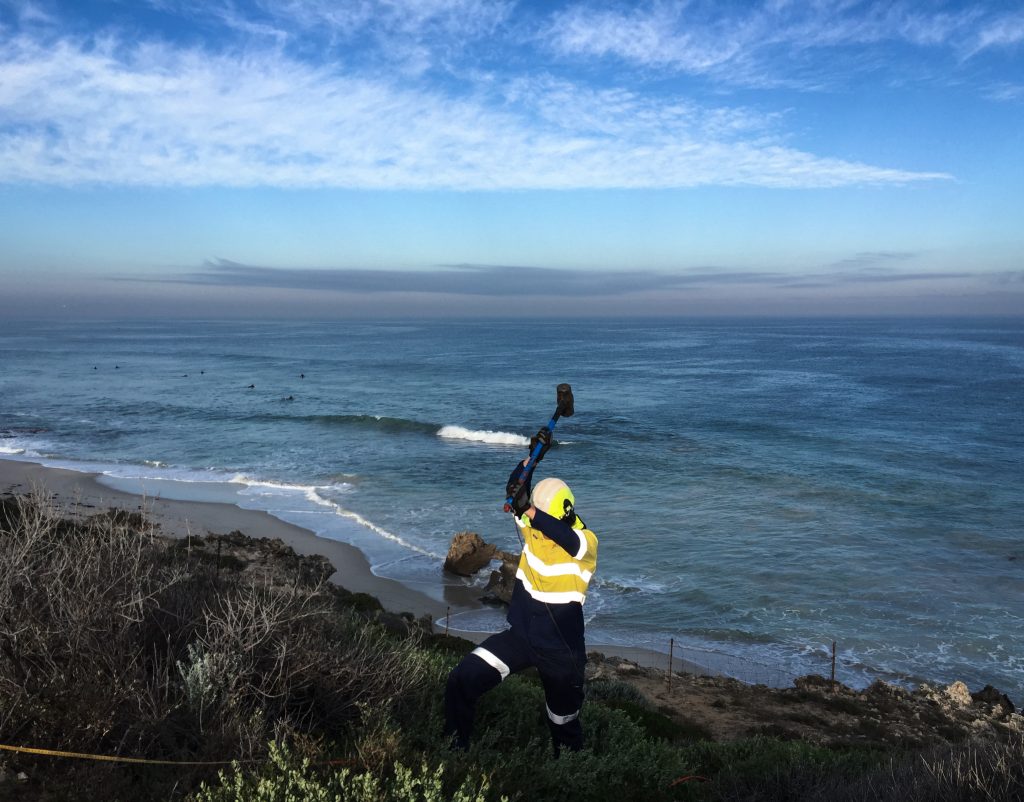
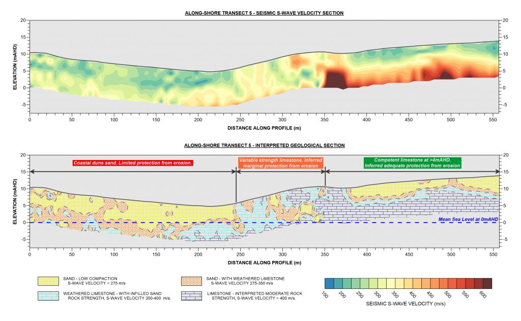
We were commissioned by a local council within the Perth metro region to carry out a geophysical investigation over a 3.8 km section of the coastline as part of the CHRMAP process. During the investigation of over 5 km of geophysical profiling using Seismic Refraction, Seismic Refraction and Multi-channel Analysis of Surface Waves (MASW) was carried out as a series of transects parallel and perpendicular to the coastline.
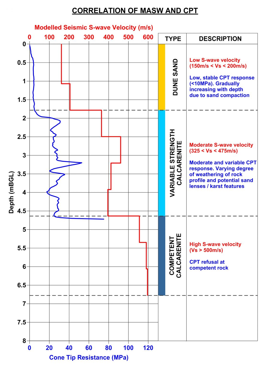
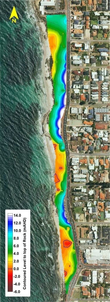
The geophysical datasets were processed and inverted to provide cross-sections showing variations in the seismic wave velocity of the subsurface material. The velocity sections were demarcated into velocity ranges for the generation of interpreted geological sections showing the modelled depth to the top of rock relative to Mean Sea Level. The top of the rock as modelled along the seismic transects was gridded to generate a Digital Terrain Model (DTM) of the underlying rock profile.
The results of the geophysical investigation proved that certain sections of the coastline did have competent limestone at shallow depths sufficient to act as a barrier against erosion. Furthermore, the results showed sections of vulnerable coastline where the rock was not observed, enabling the council to determine which assets and infrastructure were most at risk.
Case Studies
GBG has completed over 1000 projects since its conception with multiple stakeholders and countless clients. GBG is proud to showcase some of these projects.
Enquire Now
We look forward to discussing your project with you, please complete the form below or contact one of our offices directly.
Please note: GBG Group is compliant with the General Data Protection Regulation (GDPR). To learn more about how we collect, keep, and process your private information in compliance with GDPR, please view our privacy policy. *

Contact Us - NSW


Contact Us - WA