
Induced Polarisation
Find the electrical charge of the subsurface for mineral exploration, environmental assessment and engineering geophysics.
Applications
- Mapping and monitoring leachate plumes
- Mapping and monitoring of groundwater pollution
- Landfill investigations
- Mapping buried dykes and other ore bodies
Method
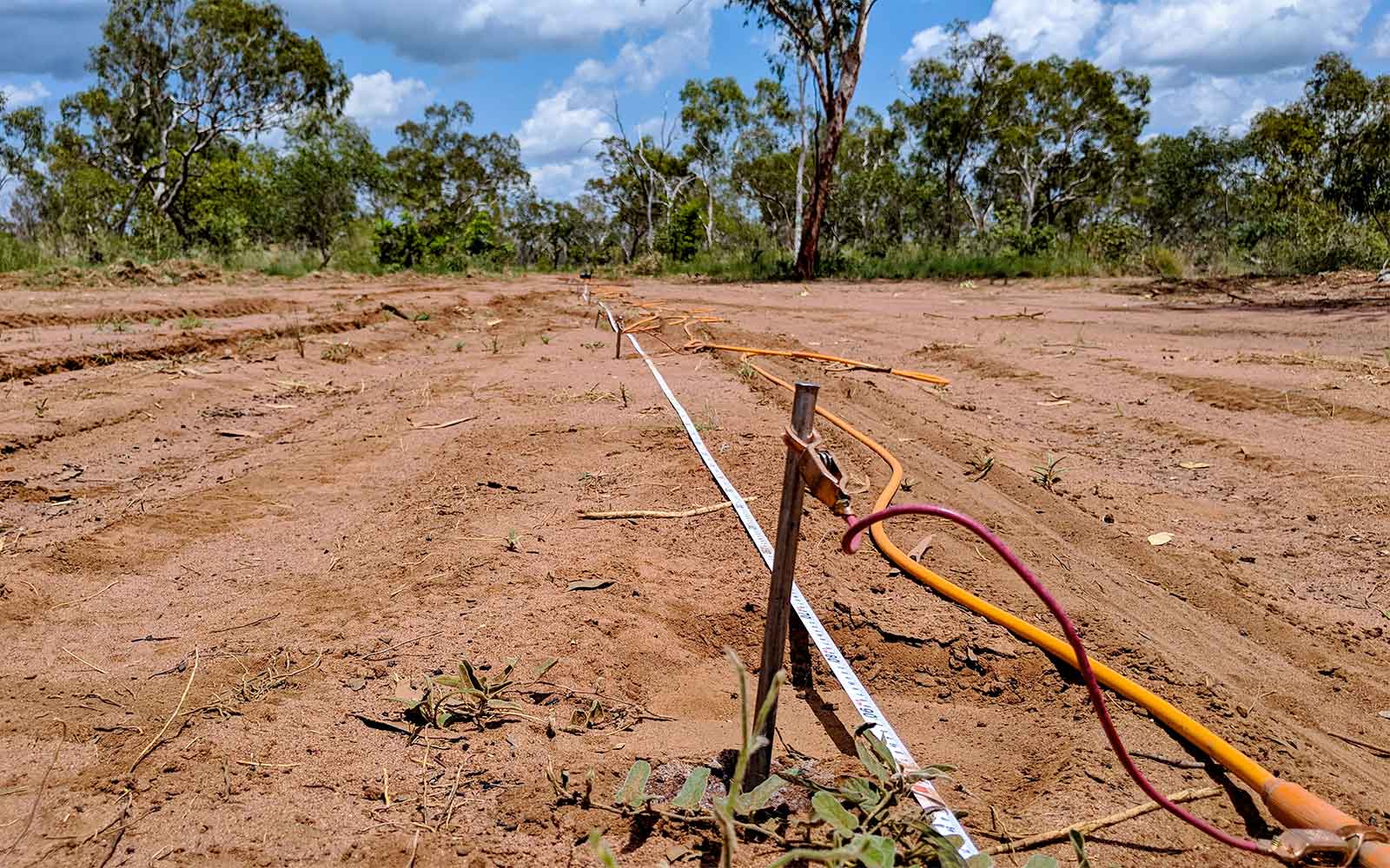
The Induced Polarisation (IP) method extends the resistivity methods by making an additional measurement of the ability of the ground to store electrical charge. Originally developed for mineral exploration, it is now finding applications in the fields of environmental and engineering geophysics. The method measures the rates with which electrical charges build up in the ground due to applied voltages, and with which they re-equilibrate after such voltages are removed. Common sources of the effect are charge polarisation on individual grains, charge buildup within clay layers, and electrochemical interactions at grain surfaces.
As the IP effect results from currents passing through the ground, IP surveys measure resistivity in addition to some index of polarisation. The polarisation index that is reported is different for different IP equipment; it may be chargeability in mV-sec/V, per cent frequency effect, or phase shift in milliradians (mR) between transmitted and received signals. The equipment used in IP surveys is similar to that used for electrical resistivity, with measurements being made of both the resistivity and chargeability of the subsurface. The survey typically comprises several ground electrodes in deployed an array connected to a computer-controlled multi-channel receiver.
Data Analysis & Presentation
Typically most inversion software for IP data utilises algorithms such as the complex resistivity method which incorporates both apparent resistivity methods which incorporate both apparent resistivity and IP datasets. As such data from IP surveys are commonly presented as one cross-section for resistivity and one for chargeability in the various polarisation index used.
Tailings Management: Get in touch
Consider a 'Tailings First' approach for your facility and avoid creating a potentially catastrophic risk for the environment.
GBG combines industry-proven geophysical methods, geotechnical physical characterisation, hydrogeological modeling and assessment, and airborne methods for point-based data capture in assessing your requirements. Talk to us today for more information regarding this essential service for your tailings facility.
Case Studies
GBG has completed over 1000 projects since its conception with multiple stakeholders and countless clients. GBG is proud to showcase some of these projects.
Enquire Now
We look forward to discussing your project with you, please complete the form below or contact one of our offices directly.
Please note: GBG Group is compliant with the General Data Protection Regulation (GDPR). To learn more about how we collect, keep, and process your private information in compliance with GDPR, please view our privacy policy. *

Contact Us - NSW


Contact Us - WA